
Tropical Storm Erin Advances Through Central Atlantic
especiales
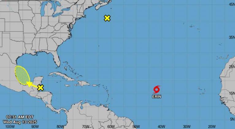
Tropical Storm Erin continues moving westward through the central Atlantic with maximum sustained winds of 75 km/h (45 mph), according to the latest advisory from the National Hurricane Center (NHC).
The NHC has issued watches for the northern Leeward Islands, Virgin Islands, and Puerto Rico, where life-threatening surf and rip current conditions are expected in coming days.
As of the 11:00 AM EDT update:
-
Location: 16.5°N, 41.9°W
-
Movement: West at 31 km/h (20 mph)
-
Forecast Track: Expected to turn west-northwest tonight, continuing through weekend
-
Projected Path: Center likely to pass near/north of northern Leeward Islands this weekend
Meteorologists anticipate gradual strengthening today, with Erin likely becoming a hurricane by late Thursday or early Friday. The storm could bring:
-
Tropical storm conditions to watch areas by Friday
-
75-150 mm (3-6 inches) of rainfall, with isolated 200 mm (8 inches)
-
Dangerous coastal surf
Residents in affected areas should monitor updates and prepare hurricane kits. The NHC will issue its next complete advisory at 5:00 PM EDT.


Add new comment